Williams’ Tract
Williams’ Tract, dating from the 18th Century, would, after the annexation by the Town of Lansingburgh of land south of the Deep Kill from the Town of Schaghticoke, form a large portion of Northern Lansingburgh north of the Patent of Stone Arabia and north of Thieves Hollow. It’s seen below on a map ca. 1761.
Surnames appearing on old maps include:
1854: Cole, Levens, Weatherwax
1861: Carroll, Chase, Grant, Groesbeck, Holmes, Leavens, Patch, Weatherwax
1870: Chase, Cipperley, Collins, Groesbeck, Leaven, Lowrie, Russell, Weatherwax, Wolf
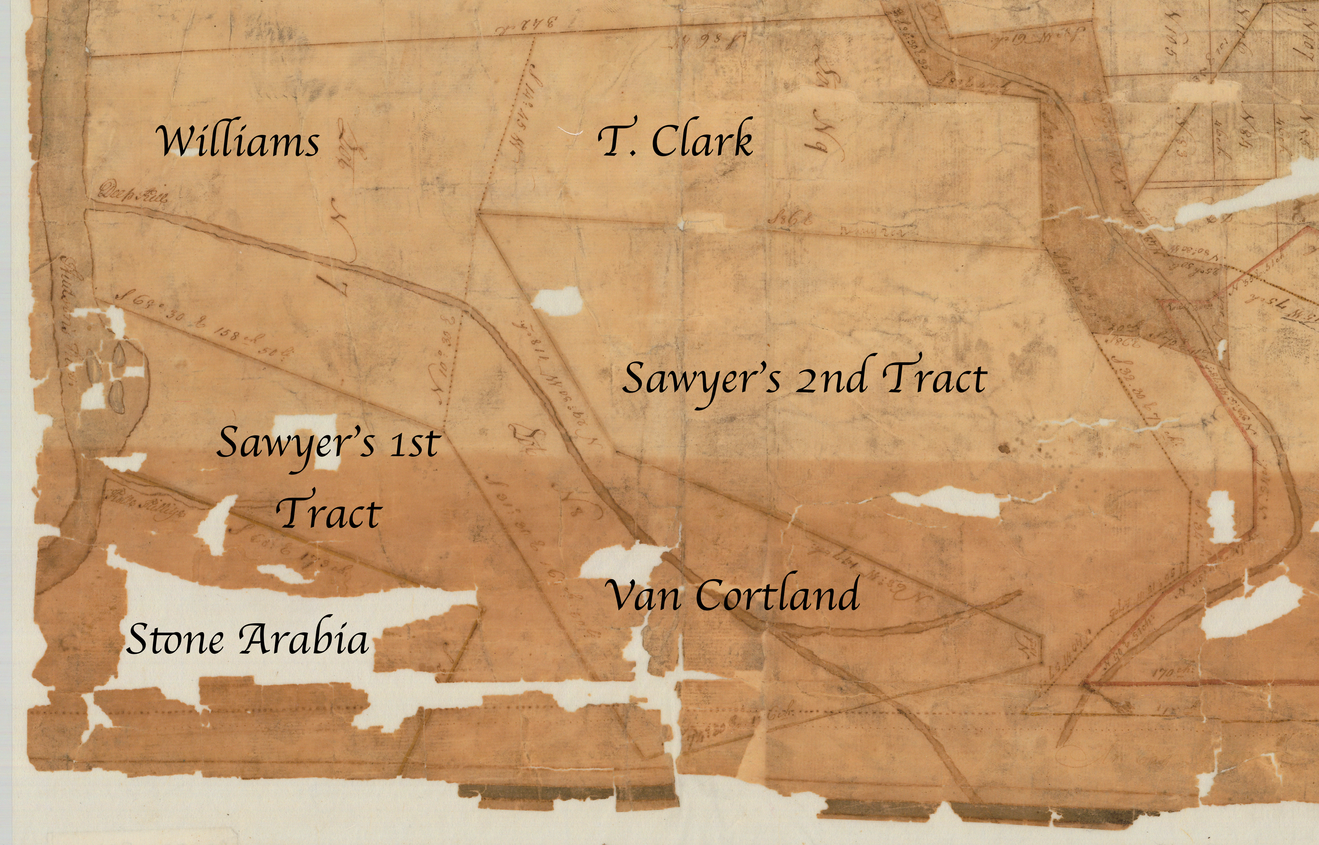
Detail cropped and annotated from “Map of a tract of land, granted to Isaac Sawyer and others called Pitt’s Town.” http://digitalcollections.archives.nysed.gov/index.php/Detail/Object/Show/object_id/36917